CODOS Update for Northern, Front Range, and Grand Mesa CODOS sites
Late April and early May snowfalls have served to both increase snowpacks in the northern and Front Range mountains while also largely delaying the effects of WY 2013 dust events D6 (April 8) and D8 (April 15-17) on snowmelt. A recently completed circuit of six CODOS sites found a variety of conditions in the upper snowpack, with D8 well covered by clean snow in the Front Range but already exposed at the snowpack surface farther north. (This circuit, and a recent circuit of our southwestern sites, verified that event D8 produced very heavy dust deposition statewide). In the Front Range, the inevitable emergence of D8 will require ablation of clean snow containing approximately 2-4” of SWE, assuming no additional new snow. As of this writing, snowmelt rates at some of the Snotel sites associated with our CODOS sites are already accelerating. All CODOS snow profiles performed on this circuit found isothermal snowcover at 0° C throughout (with the exception of subfreezing temperatures at the very surface, in early morning).
CODOS Site & Adjacent Snotel |
SWE at Snotel as of 0001 hours |
Measured SWE above D8 dust at CODOS Site |
||
Date |
SWE |
Date |
SWE |
|
Hoosier Pass |
May 9, 2013 |
16.4” |
May 9, 2013 |
3.1” |
Grizzly Peak |
May 10, 2013 |
17.6” |
May 10, 2013 |
2.4” |
Berthoud Summit |
May 10, 2013 |
22.9” |
May 10, 2013 |
3.4” |
Willow Creek Pass |
May 10, 2013 |
18.7” |
May 10, 2013 |
0.0” |
Rabbit Ears Pass |
May 11, 2013 |
19.3” |
May 11, 2013 |
0.0” |
Grand Mesa (Mesa Lakes) |
May 11, 2013 |
12.9” |
May 11, 2013 |
1.1” |
Table 1: SWE conditions at Snotel sites adjoining Front Range and northern CODOS monitoring sites, and measured SWE now overlying dust-on-snow layer D8 (April 15-17) at those CODOS sites. Snotel data are as of 0001 hours (just after midnight) the day of the CODOS site visit. |
||||
The photos below illustrate conditions at those six CODOS sites, and in their locales, during the recent site visits.
| Hoosier Pass | ||
 |
 |
|
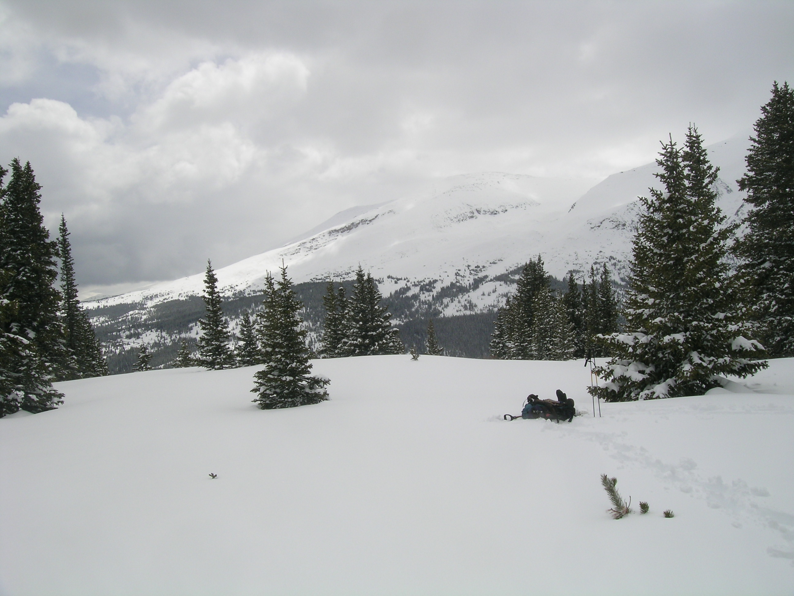
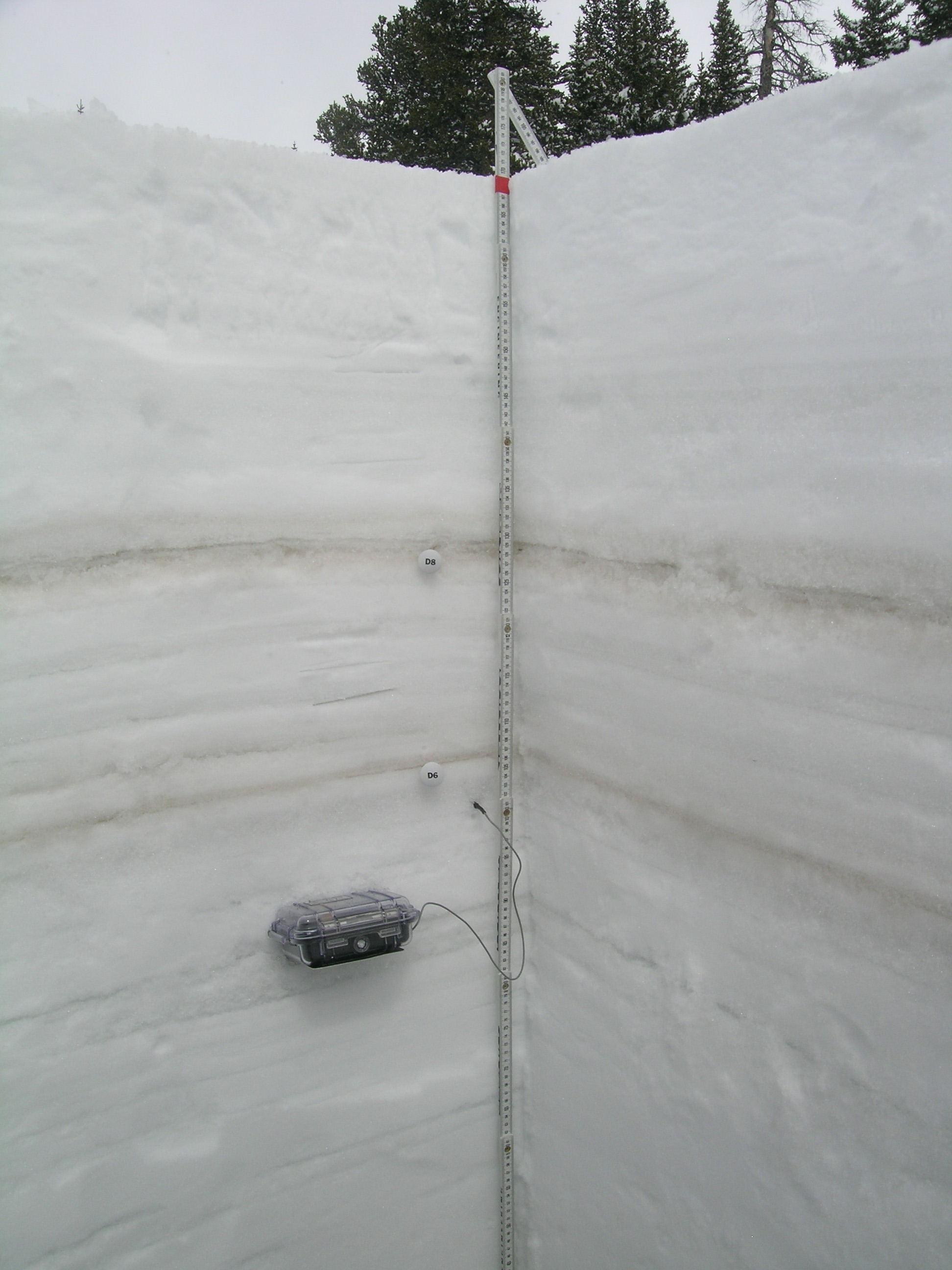
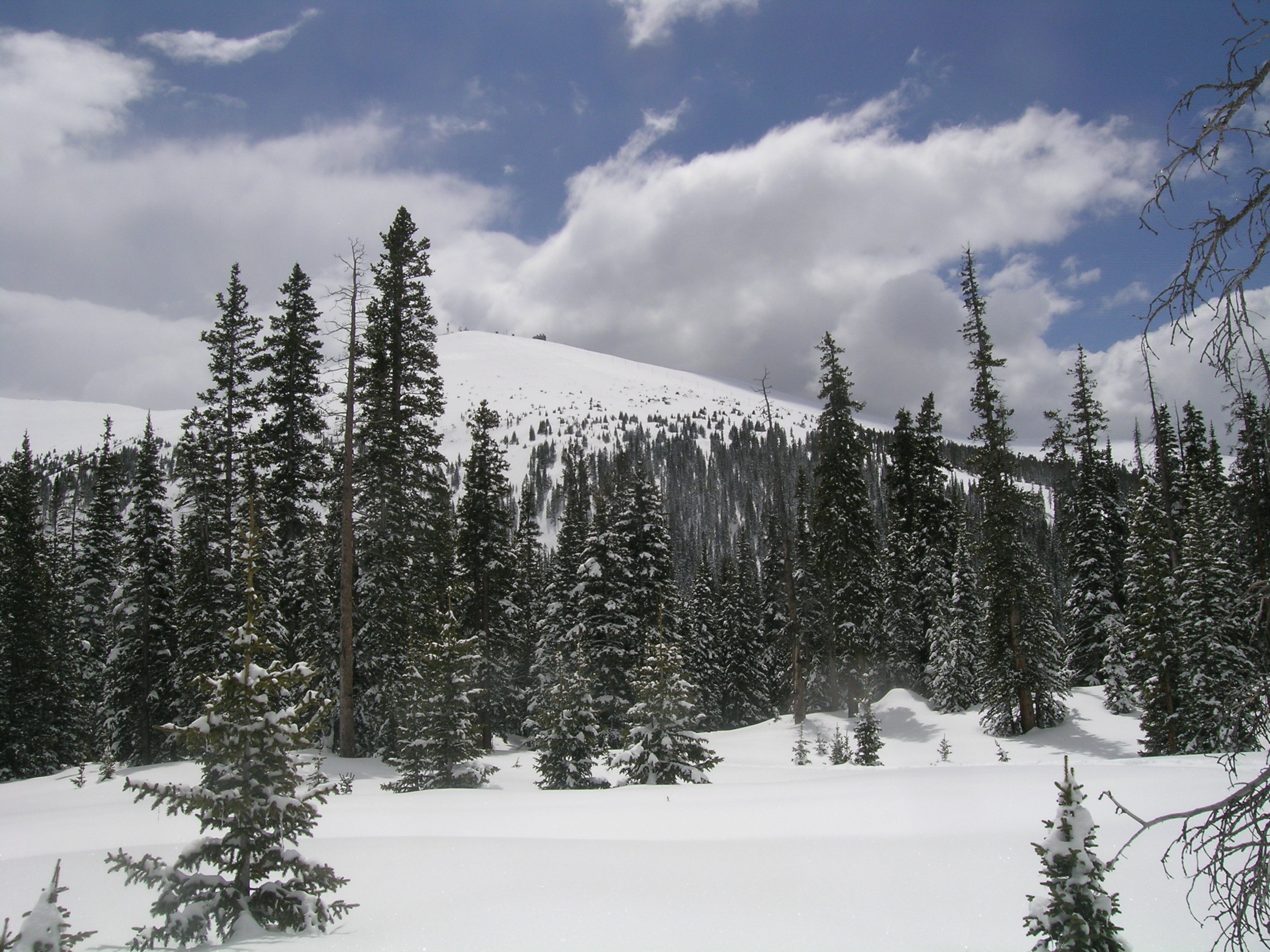
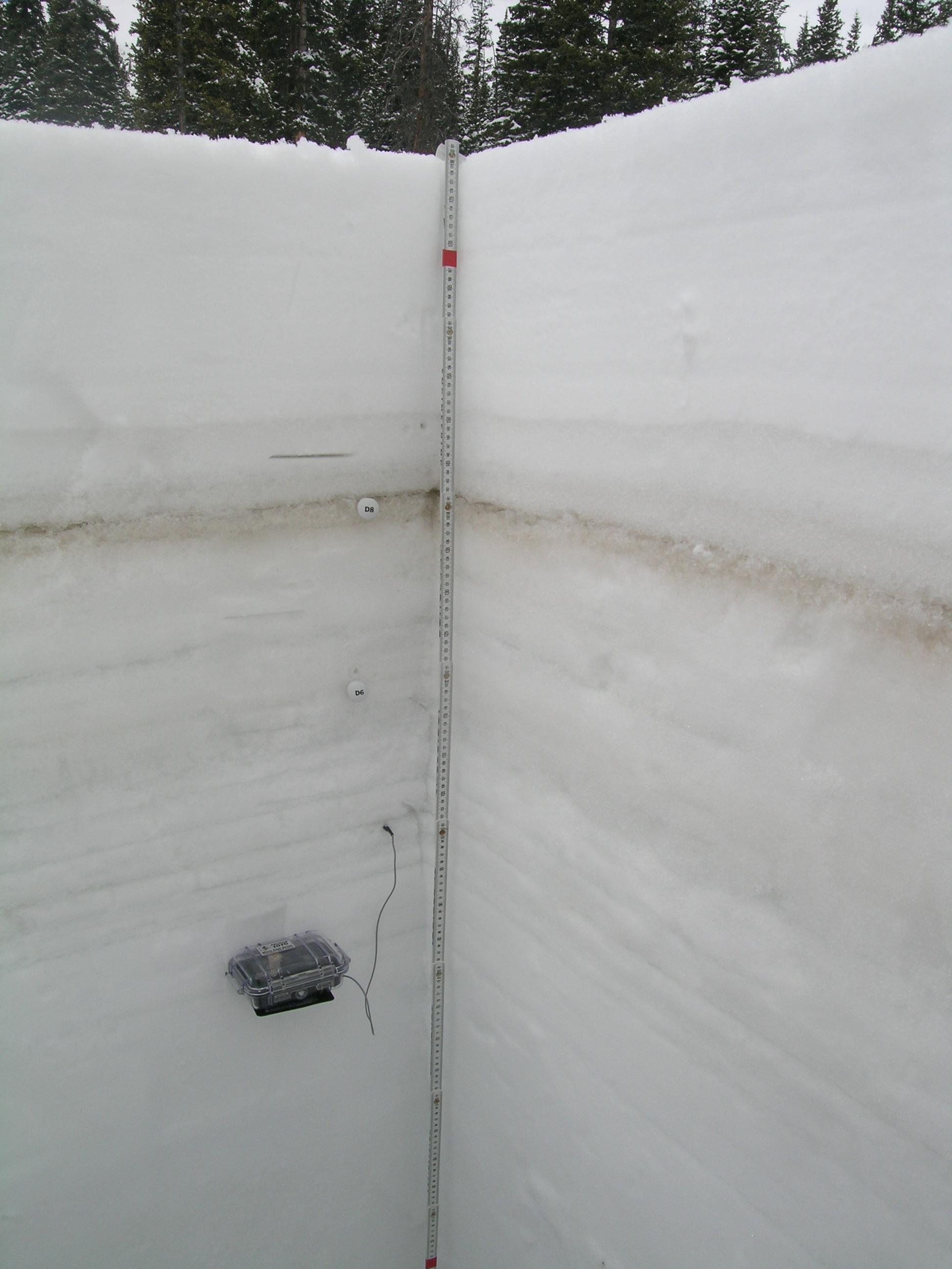
| Looking southwest at Mount Bross (14,172’) and the Mosquito Range from the Hoosier Pass CODOS site late on the afternoon of May 9, 2013. No dust-in-snow was visible at the snowcover surface. | The May 9, 2013 Hoosier Pass snow pit showing dust layers D8 (above) and D6 (below). The clean snow above layer D8 contained 3.1” SWE. |
| Grizzly Peak | ||
 |
 |
|
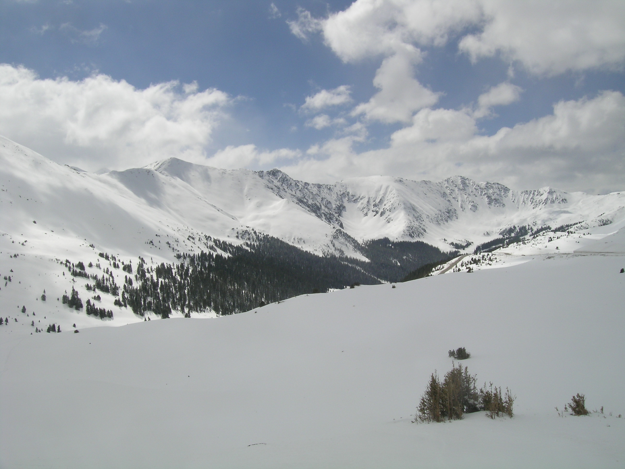
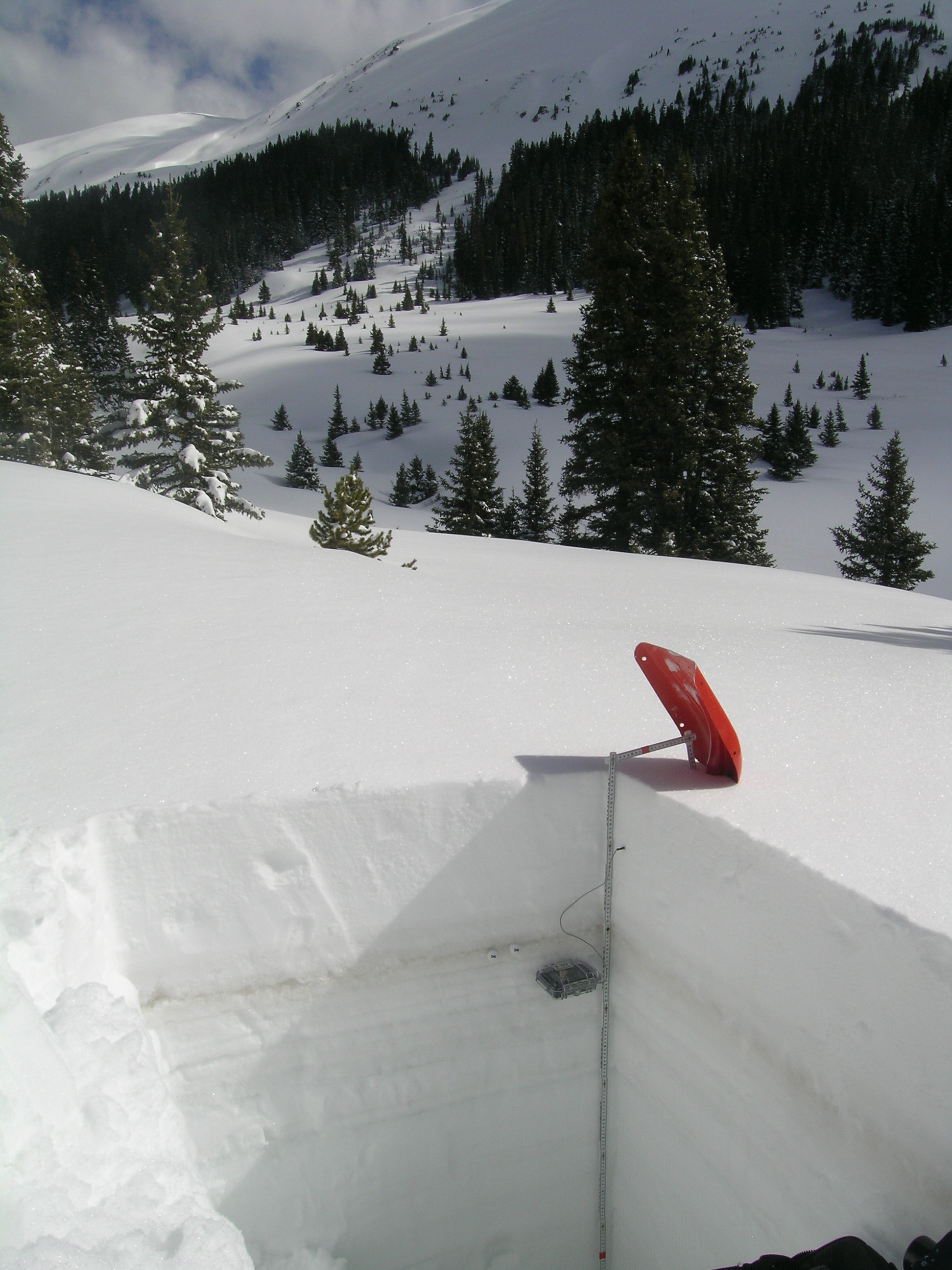
| Looking southeast from Loveland Pass on May 10, 2013 at Grizzly Peak (13,427’) in the distant center and Arapahoe Basin ski area on the right. No dust-in-snow was visible at the snowcover surface, but some cornices did reveal dust, probably D8. | The May 10, 2013 snow pit at the Grizzly Peak CODOS site. Dust layers D8 and D6 have already merged and were covered by clean snow containing 2.4” of SWE |
| Berthoud Pass | ||
 |
 |
|
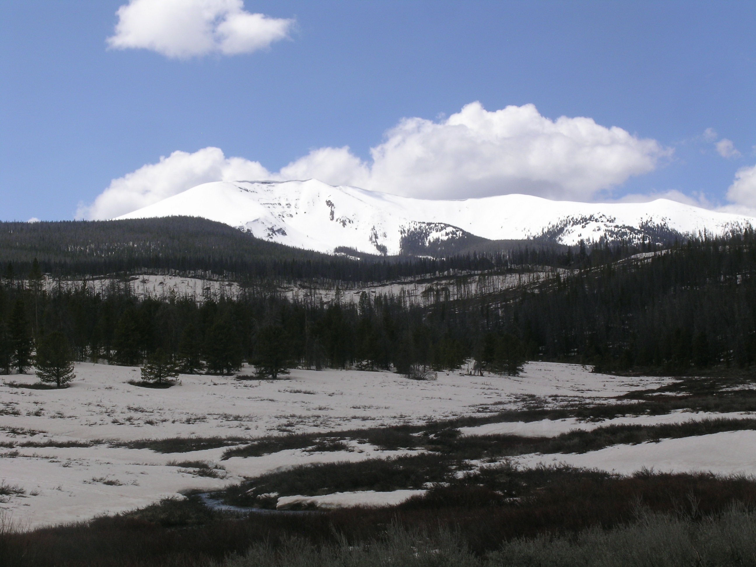
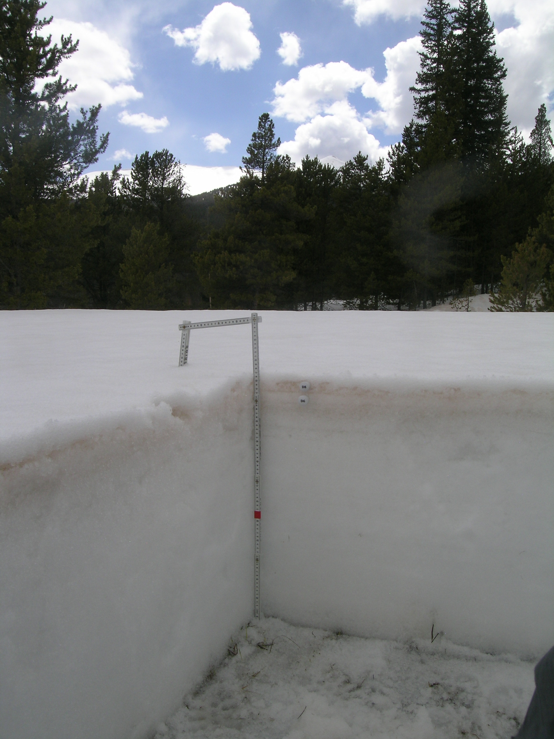
| A view from the Berthoud Summit Snotel and CODOS site of Colorado Mines Peak (12,493’) above Berthoud Pass, on May 10, 2013. | The Berthoud Pass (Berthoud Summit) CODOS snow pit on May 10, 2013 showing dust layer D8 prominently, and a weak layer D6 below. D8 was covered by clean snow containing 3.4” of SWE. |
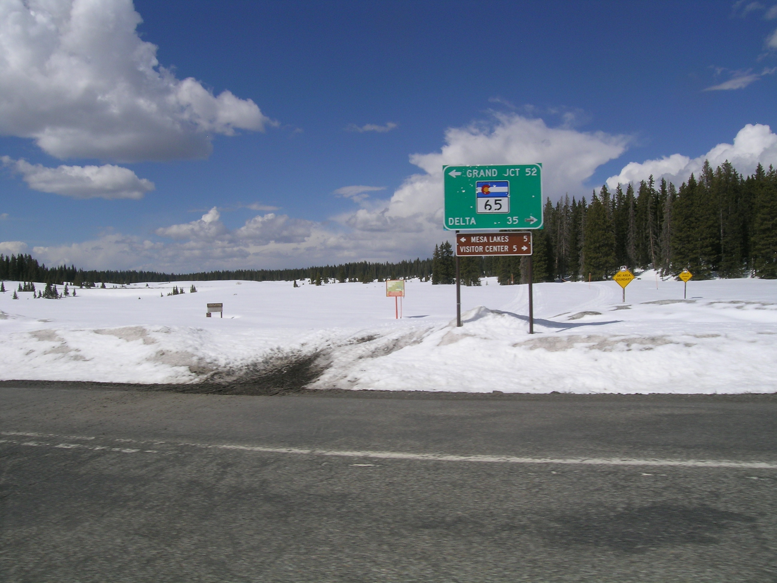
| Willow Creek Pass | ||
 |
 |
|
| A view looking west from State Highway 125, on the approach to Willow Creek Pass, looking toward Parkview Mountain (12,296’). Dust layer D8 was completely emerged at the surface of the lowest snow cover but the alpine terrain showed only small patches of exposed dust. | Dust layer D8, merged with a much weaker D6 layer, was only very thinly covered with effectively transparent snow in the May 10, 2013 snow pit at the Willow Creek Pass CODOS site. The snowpack surface, including the dust layers, was saturated with free water. Parkview Mountain is in the distance. |
| Rabbit Ears Pass | ||
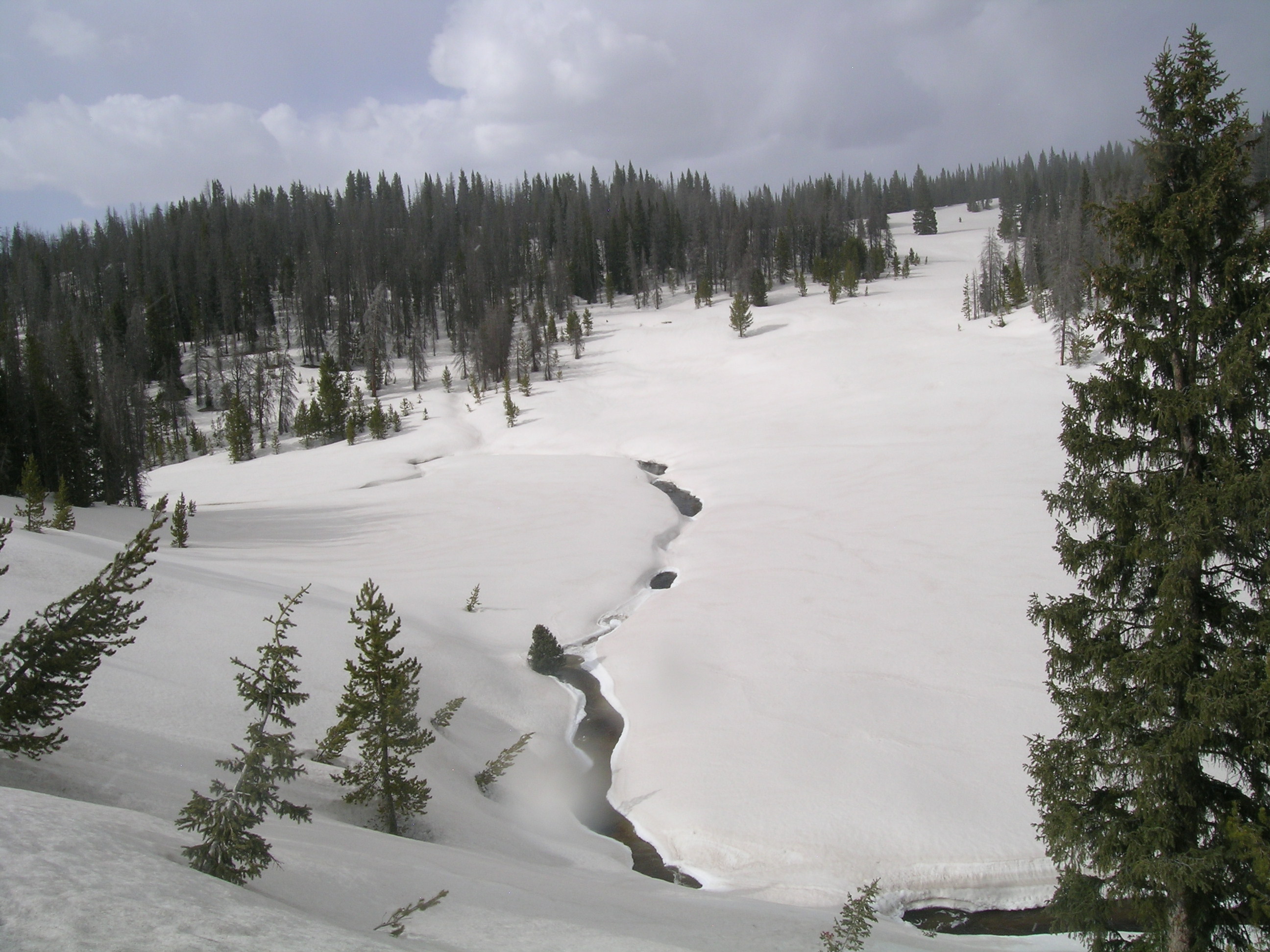 |
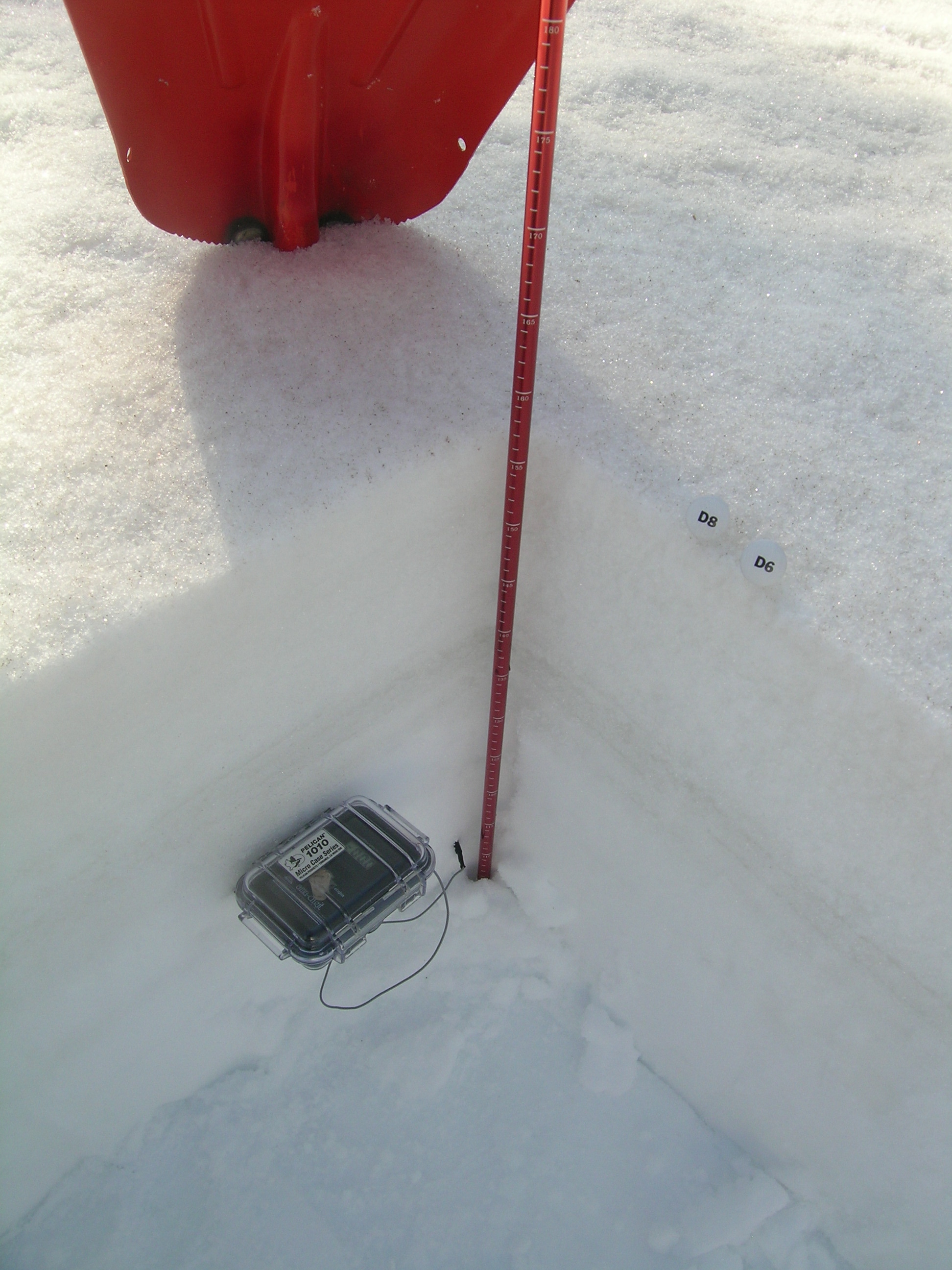 |
|
| A view from US Highway 40 of headwaters of Walton Creek on the evening of May 10, 2013. Dust layer D8 was widely exposed at the snowpack surface. In some meadows, very rapid melt had produced ponds of standing water at the snowpack surface. Interestingly, D8 intensity seemed greater on the east side of the Rabbit Ears Plateau than on the west edge, where this photo was taken and where the CODOS site is located, near the Rabbit Ears Snotel. | Dust layer D8 was exposed at the snowpack surface in the May 11, 2013 snow pit at the Rabbit Ears Pass CODOS site. The very weak D6 layer observed in the April 12 snow pit may have already merged with D8, or may be contained in the thick layers of ice seen just above the thermometer case. This photo was taken at 8 AM and the snowpack surface had thoroughly refrozen overnight, under generally clear skies. The underlying snowpack was also too dense and ‘tough’ to complete the snowpit, without risk of damaging equipment and/or operator. |
| Grand Mesa Study Plot | ||
 |
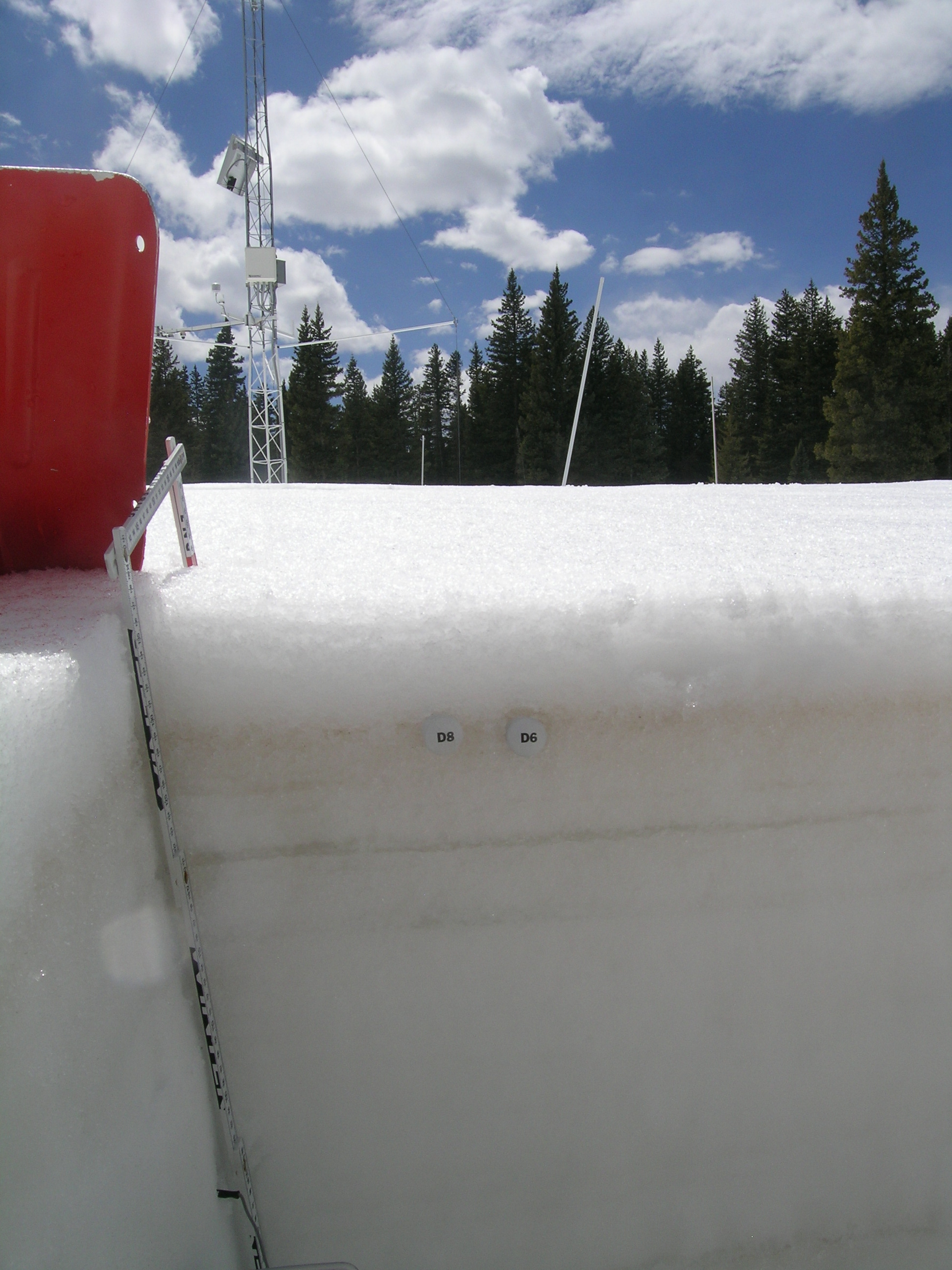 |
|
| Grand Mesa in mid-afternoon on May 11, 2013. No dust-in-snow was visible at the snowcover surface on the Mesa proper. | Dust layers D8 and D6 had merged in the May 11, 2013 snow pit at the Grand Mesa CODOS site. A thin and very wet layer of clean snow containing only 1.1” of SWE covered the merged dust layers. |
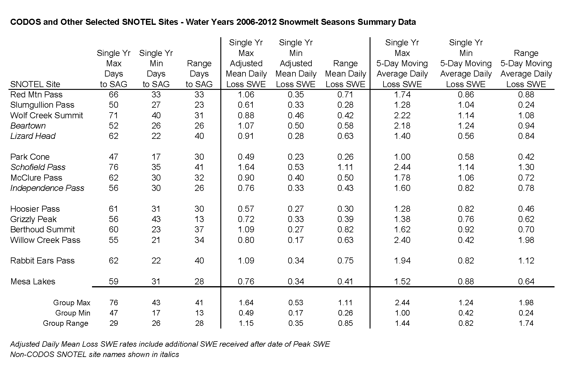
Table 2, below, presents summary data regarding snowmelt rates at those and additional Snotel sites for Water Years 2006-2012. Days to “snow all gone” (SAG), mean daily rates of SWE loss, and 5-day moving average SWE loss rates are analyzed. Table 2 is intended to provide a reminder of melt rates observed during prior seasons, and describe a range of rates that could erode the snowcover now overlying layer D8 (as shown in Table 1). It is worth noting that some of the recent late April and early May snows fell on previously bare ground. This most recent CODOS circuit found fresh snow to previously dry valley floors, and South Park completely snow covered (by 5-6” of fresh snow). However, just as radiation penetrates several inches of fresh snow to be absorbed by an underlying dust-in-snow layer near the top of a snowpack, radiation will also penetrate and ‘see’ the ground surface underneath, where snow fell on bare ground. As a result, melt rates may not differ much between fresh snow covering dust on an isothermal snowpack and the same amount of fresh snow over bare ground.
Exposure of dust layer D8 in these Front Range and northern mountain sites, and at Grand Mesa, will result in sudden accelerations of snowmelt, at all elevations, and a rapid return to and surging past the streamflow levels observed in late April. If mid-May weather remains largely sunny for a period of days, discharge levels could significantly exceed daily median values at a given gauge, under the intense radiative forcing of snowmelt produced by the heavy D8 dust layer.
As of this writing (Sunday afternoon, May 12, 2013), the National Weather Service anticipates partly sunny skies early this week at Front Range passes, with chances of afternoon showers, trending toward increasingly sunny and drier days later in the week as southwesterly flow returns. Temperatures will be in the upper 40’s and low 50’s at pass elevations. Farther north, the same general trend toward increasingly sunny and unseasonably warm weather is expected. Farther west, the Grand Mesa will see mostly sunny skies all week, with temperatures reaching 60°. Here in the southwest mountains, we may see a few diurnal showers but skies will be at least partly sunny all week and temperatures will climb to the low 60’s. In short, the expected weather conditions favor the snowmelt and runoff scenarios, enhanced by D8, described above.