CODOS Dust Alert - D8 now in 36th hour and ongoing
Good afternoon -
As mentioned in yesterday's email, event D8-WY2013 was in progress and depositing a considerable amount of new dust. CSAS's Andrew Temple was in the field very early Monday morning and found substantial fresh dust already deposited, at the base of a fresh snow layer. We deduce that the event began just before midnight Sunday, as winds made a clear and abrupt shift to the SW, at already high average speeds. This D8 event goes on, having sustained through the night, and continues as of this writing. Photos and graphs below will illustrate this event-in-progress.
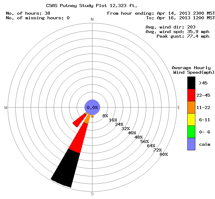
First, the wind rose for this dust event from our Putney Study Plot as of this hour. The average speed of 35.9 mph is quite high. Monday's 24-hour average speed, at almost 34 mph, was the highest single day average observed this winter. Winds rocked houses in Silverton all last night.
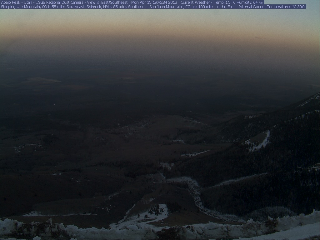
The photo below is from Abajo Peak at dawn today, Tuesday. The distinct brown layer along the horizon is dust in the air.
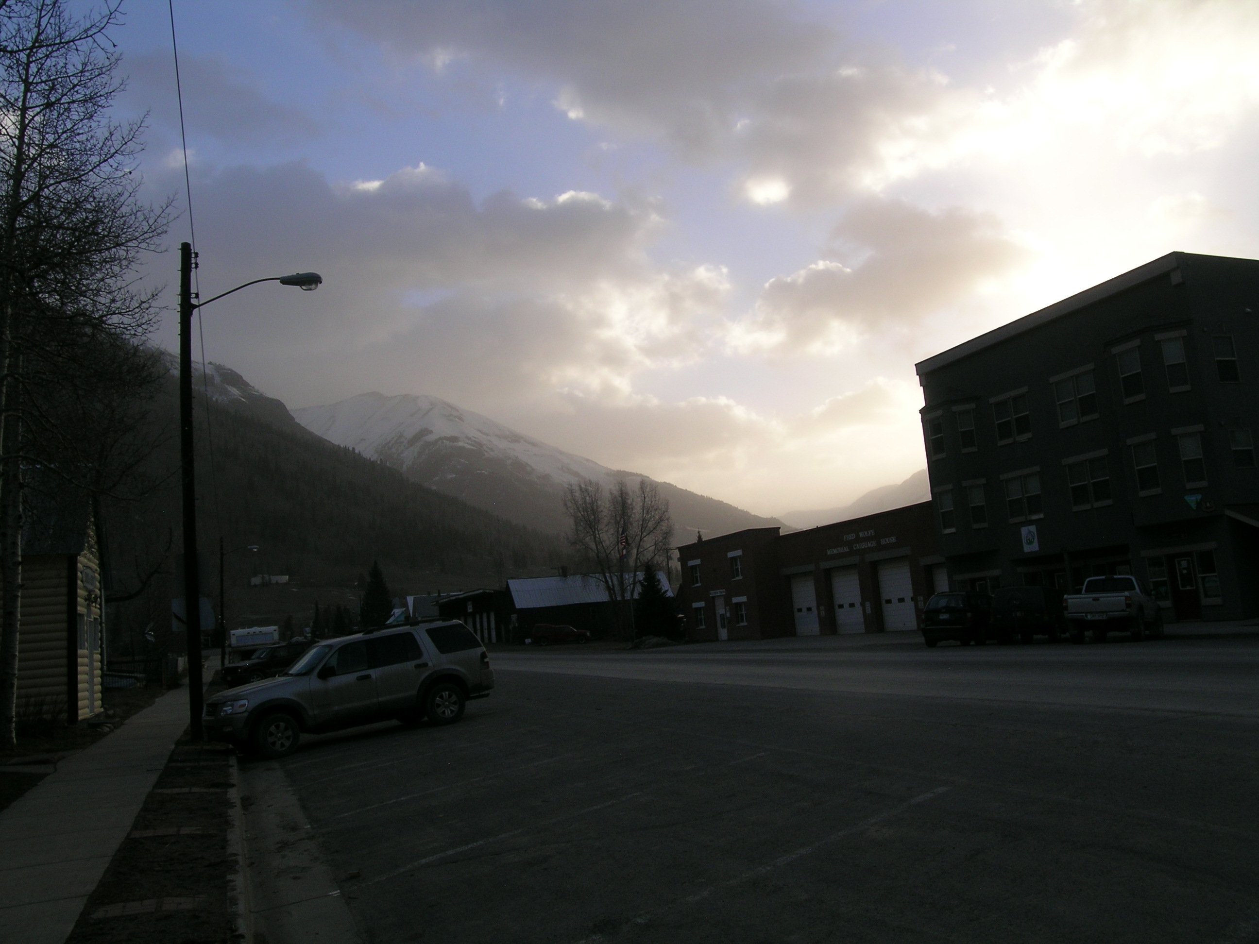
This photo (below) was taken near sunrise this morning. Our office is in the large building on the right - our logo is above the entry.
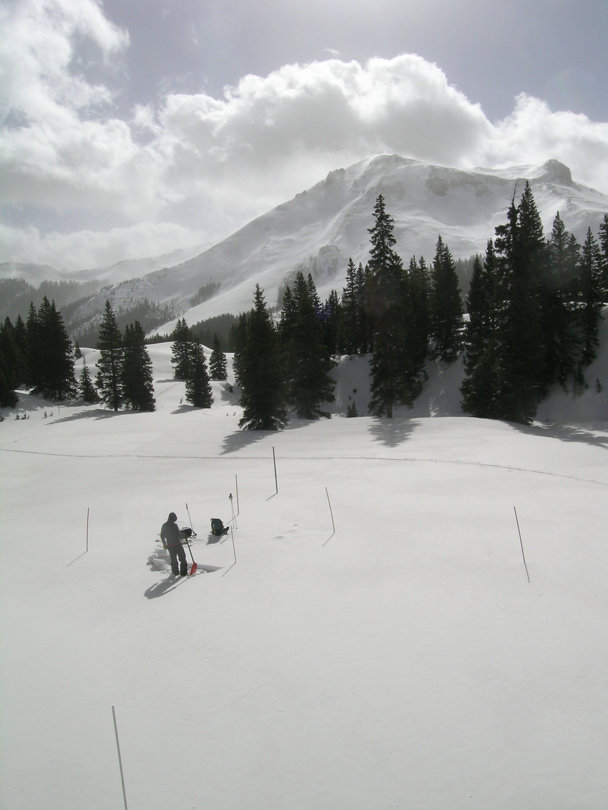
Today we performed our routine weekly snow profile at the Swamp Angel Study Plot at Senator Beck Basin. D8 dust was concentrating in the prior day's ski tracks leading to the plot.
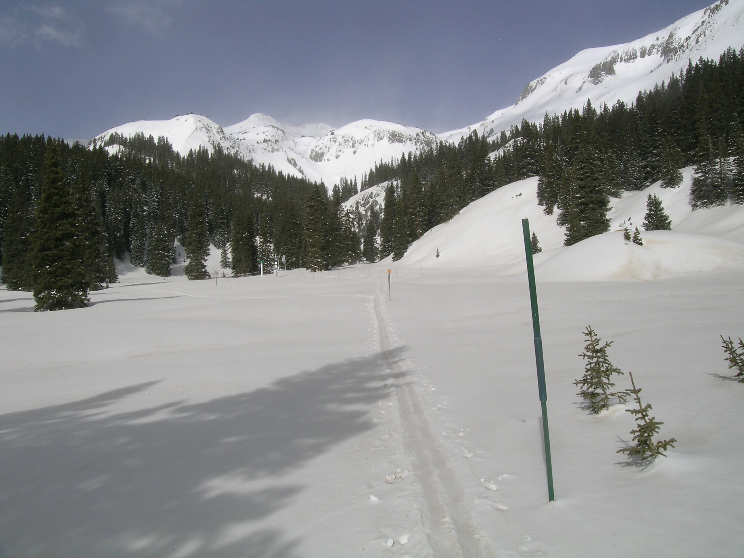
Winds continue to "rage" on the terrain around the comparatively calm, well-sheltered Swamp Angel Study Plot. Red Mountain #3 is in the background.
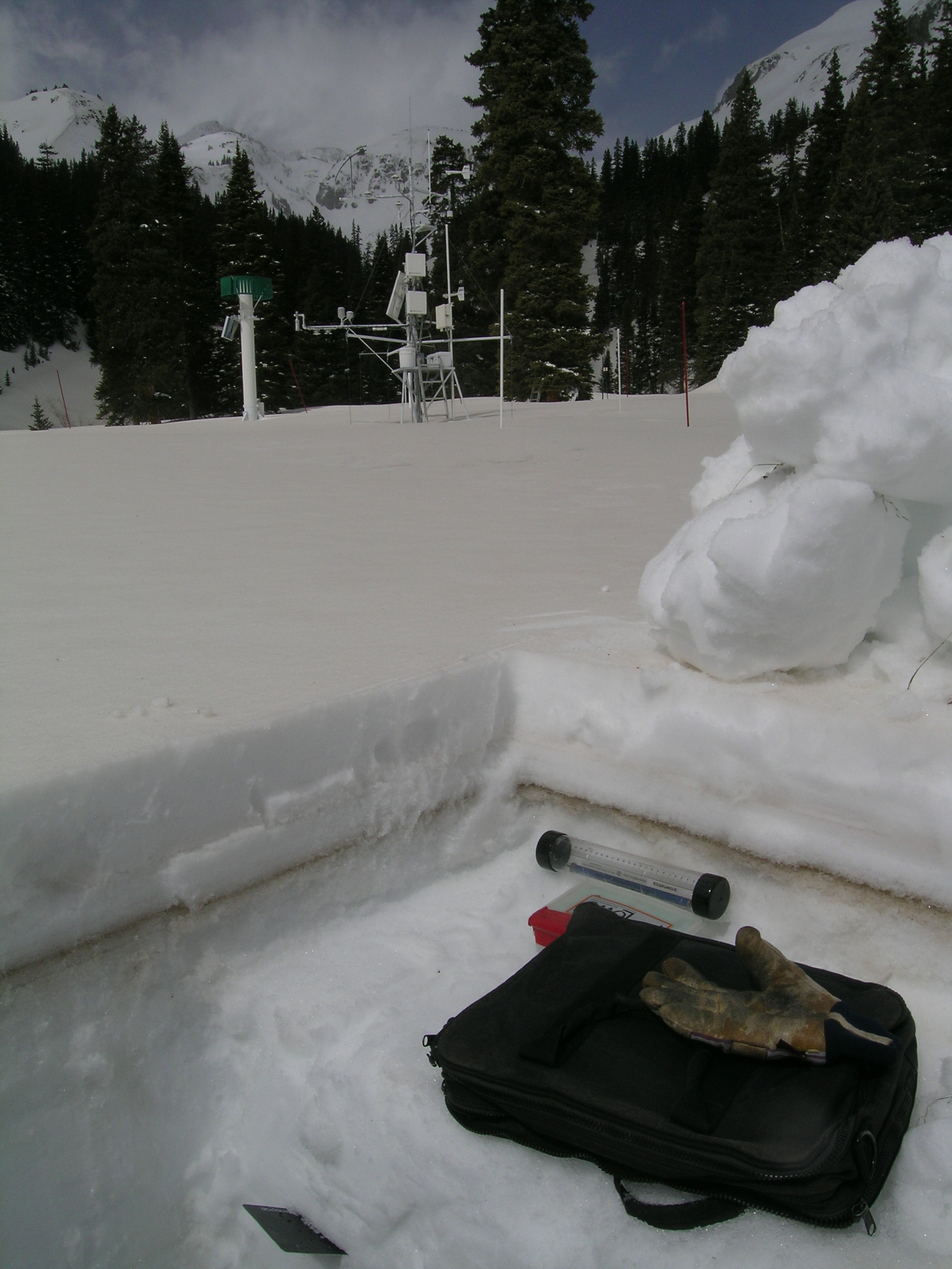
This view of today's snow pit clearly shows dust layer D6, as the very dark brown band about 10" below the surface. It is more difficult to see the D7 deposition, about 3" above the dark band. The bulk of the D7 dust layer is now about 2" thick, covered by essentially clean snow. At the very surface of the snowpack is D8, a somewhat redder layer than D7 or D6. D8 was ongoing during this session at Swamp Angel, although at somewhat lower intensity than earlier in the morning. Although clearly of much lesser magnitude than D6, event D8 alone would have represented a significant snowmelt "forcing" agent during the remainder of this spring's runoff ... it's principal effect now will be to hasten the emergence of layer D6.
That's the latest from Senator Beck Basin ... we will sample D8 when it's clearly over, but the current NWS forecast for Red Mountain Pass has sustained S'lys 20-30 for the remainder of today (we're averaging in the 40's), gusting 50 (we're gusting to the mid 70's), and SW'lys 15-25 mph, gusting 45, tonight. Lighter SSW'lys are expected Wednesday.
More soon,
Chris
Chris Landry, Executive Director
clandry@snowstudies.org
Center for Snow and Avalanche Studies
PO Box 190, Silverton, CO 81433 USA
(970) 387-5080
www.snowstudies.org

